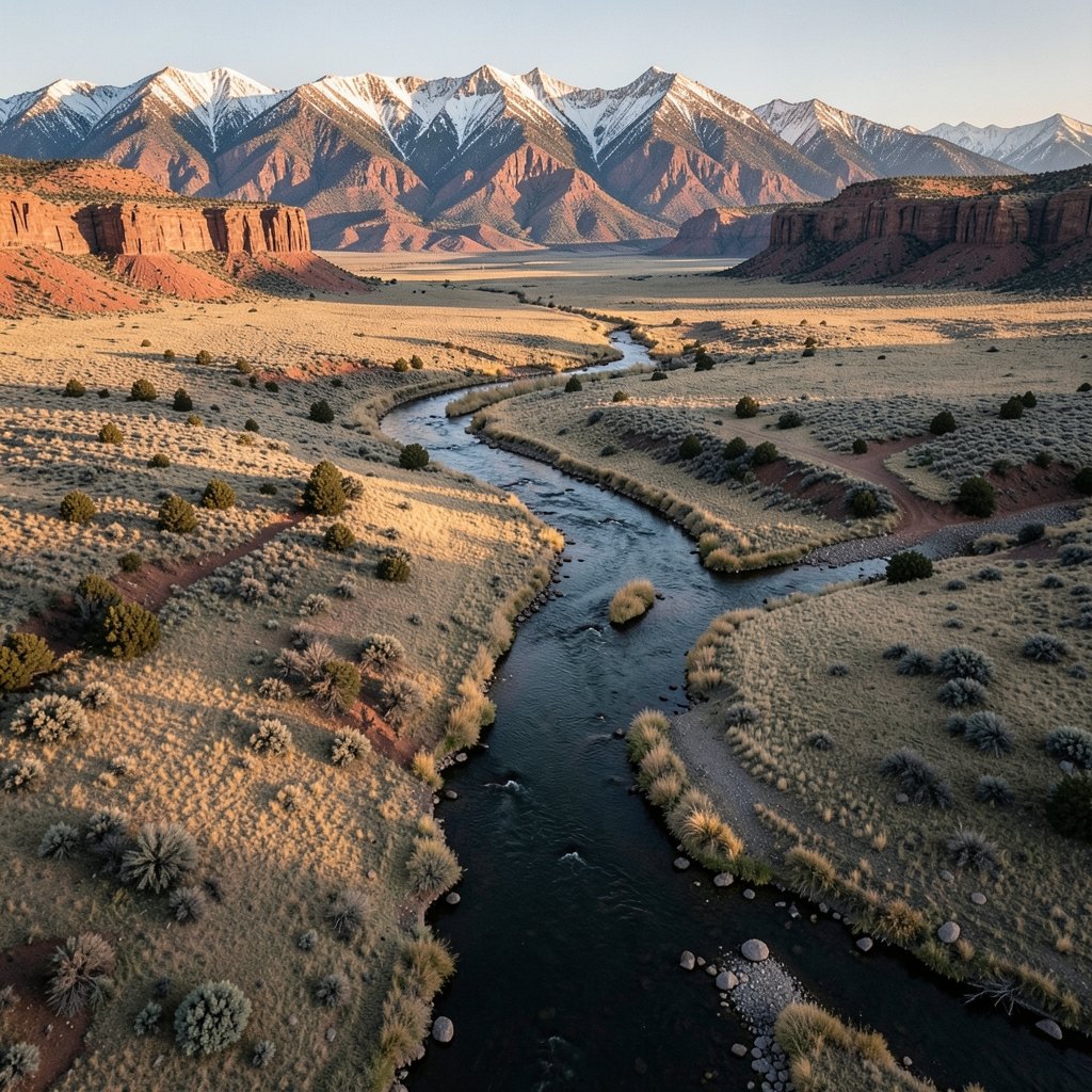
Two separate tribal nations were told to share a single reservation, and they have done so for generations. The Wind River Reservation sits in west-central Wyoming. It is one of the largest reservations in the United States and is home to the Eastern Shoshone and the Northern Arapaho. Its history combines treaty law, hard geography, and everyday community life. People working on the modern American West, tribal sovereignty, or water law eventually encounter Wind River. This article covers where the reservation is, how it came to be shared, what the land and people look like today, and the issues that shape life there.
Where Is the Wind River Reservation?
The reservation sits in the Wind River Basin in west-central Wyoming, a high, dry country of sagebrush flats, river valleys, and mountain edges. It is not a small parcel. Common figures put the reservation at roughly 2.2 million acres, or about 3,500 square miles, which places it among the largest reservations in the country.
That size matters for practical reasons. Distances between communities are long, weather is severe in winter, and services that a town might take for granted, from clinics to grocery stores, can be an hour’s drive away. Readers who think about how rural communities manage daily logistics will recognize the pattern. It is the same kind of distance problem that makes daily in home care in Indian River County a logistical puzzle rather than a simple service, even though the geography and the community are entirely different.
The reservation is also one of the few in the United States shared by two distinct tribal nations. That single fact drives much of the reservation’s politics, law, and identity.
How the Reservation Came to Be Shared

The legal foundation is the Fort Bridger Treaty of July 3, 1868, which established a Shoshone and Bannock reservation covering a far larger area than today’s boundaries. Over the following decades, the reservation was reduced to its present size, a pattern repeated across the American West.
Then came the twist. In 1878, the Northern Arapaho were placed on the Shoshone reservation, initially as a temporary arrangement. They never left. What began as a short-term placement hardened into a permanent shared homeland, and the two-tribe structure has defined Wind River ever since.
This history explains why the reservation has two tribal councils, two court systems, and a joint body that handles matters of common concern. Treaties are the foundational documents of that arrangement. They are still read closely today because they define rights that courts continue to interpret.
Who Lives There Today
According to the 2020 U.S. Census, roughly 27,000 people live on the reservation, with a substantial share identifying as American Indian or Alaska Native. Exact counts differ between Census and tribal sources, and that gap is worth taking seriously. Population figures for reservations are notoriously sensitive to how boundaries, enrollment, and residency are defined.
A practical tip for anyone researching demographics: never rely on a single number. Check whether a figure refers to the reservation as a legal boundary, a Census statistical area, or tribal enrollment. Those are three different things, and mixing them produces bad conclusions.
How the Two Tribes Govern
Governance at Wind River is layered. The Eastern Shoshone and the Northern Arapaho each have their own tribal councils. A Joint Business Council handles matters that affect both nations. Separate tribal courts and law enforcement structures operate alongside the joint framework.
Sovereignty here is genuinely complex, and that complexity is not a flaw so much as a consequence of shared status. Two governments on one land base must negotiate everything from budget allocations to jurisdictional questions. For outsiders, the lesson is simple: do not assume a single point of contact. Whether the question is a business inquiry, a legal matter, or a research project, knowing which government has authority over which issue saves time and prevents mistakes.
Water Rights and the Big Horn Decision
If there is one legal case that anyone studying Wind River should know, it is the 1989 Wyoming Supreme Court decision in the general adjudication of water rights in the Big Horn River system, often called the Big Horn or Wind River water rights case. The ruling quantified tribal water rights, and it became a landmark in Indian water law nationwide.
Why does water matter so much in a high desert basin? Because in the West, water is the limiting factor for agriculture, municipal growth, and energy development. A quantified tribal right is not an abstraction. It shapes what can be built, irrigated, or sold, and it gives the tribes leverage in negotiations that stretch across decades.
The case also illustrates a broader principle: treaty rights and court decisions from the late nineteenth and twentieth centuries still structure daily economic reality. Anyone who treats Western water law as dry technical material has not tried to develop a project in a basin where rights are already spoken for.
Economy, Energy, and Wind
The reservation has oil and gas development and wind energy resources. Several wind projects have been proposed or built over the years. The reservation’s name and the resource share a word, which is a coincidence of geography rather than a branding exercise, but the overlap is real.
Energy development on tribal land raises familiar questions in an unfamiliar legal setting. Who owns the resource? Who negotiates the lease? How are revenues shared between two nations? How are environmental impacts weighed against jobs? These are the same questions any resource economy faces, filtered through a sovereign framework that predates most state regulations.
For readers interested in how wind technology itself is discussed in consumer contexts, the vocabulary can get confusing fast. The same word appears in topics as different as turbine siting and headphone design, which is why explanations of wireless earbuds wind noise reduction that actually works exist alongside policy debates about wind farms. Context is everything.
Health and Social Realities
Public-health reporting has documented elevated rates of poverty, diabetes, and suicide on the reservation relative to state and national averages. These are serious indicators, and they deserve more than a passing mention.
A few honest cautions apply. Figures vary by year and by source. A number pulled from a news article may not match a public-health dataset, and neither may match tribal reporting. The responsible approach is to cite a specific dataset with a date rather than repeat a general claim. It is also worth remembering that statistics describe conditions, not people. A community with high measured need is also a community with institutions, families, and programs working on those problems.
For anyone comparing health access across rural areas, the structural issues rhyme with other underserved regions: distance to specialists, workforce shortages, and the difficulty of recruiting providers to remote places. The specific history and legal status are unique to Indian Country, but the logistics are familiar to rural health planners everywhere.
Common Mistakes People Make When Researching Wind River
A surprising amount of confusion about the reservation comes from small errors that compound. Here are the ones that show up most often.
First, treating the reservation as a single tribe. It is two nations with separate governments. Second, assuming the 1868 boundaries are today’s boundaries. They are not. Third, quoting a population figure without saying which source and which year. Fourth, assuming state law applies uniformly. Sovereignty means it often does not.
There is also a technical trap that catches people working with digital records. Tribal documents, maps, and datasets are frequently stored on removable media or archived drives, and a corrupted file system can stall research for days. Knowing how to format a USB drive on Windows 11 without losing data is the kind of unglamorous skill that saves an archive. It has nothing to do with Wind River specifically, but everything to do with preserving the records that make research possible.
Why the Reservation Matters Beyond Wyoming
Wind River is a test case for questions that reach far past its borders. How do two sovereign nations share one land base? How do treaty rights from the 1860s shape twenty-first-century economics? How does a rural community deliver services across thousands of square miles?
The answers matter to anyone interested in federal Indian law, Western water policy, or rural development. They also matter to readers who simply want to understand a place that appears in news coverage about energy, jurisdiction, and health, usually without much context.
One more practical note for anyone comparing technical or policy cases: the details that decide outcomes are often buried in procedure rather than principle. The same is true in fields as far apart as controller configuration, where the choice between tools hinges on small compatibility details, which is why comparisons like DS4Windows vs rewasd vs Steam Input come down to specifics rather than broad claims. Wind River’s water adjudication followed the same pattern: the headline was sovereignty, but the ruling turned on measurement and priority.
Conclusion
The Wind River Reservation is not a footnote in Wyoming’s map. It is a working example of shared sovereignty, shaped by an 1868 treaty, altered by an 1878 placement, and still being negotiated in courtrooms and council chambers today. Two tribes, the Eastern Shoshone and the Northern Arapaho, govern a land base of roughly 2.2 million acres with a population near 27,000, and they do it while managing water rights, energy development, and serious public-health challenges.
What makes the place worth understanding is precisely what makes it complicated. The dual-government structure is unusual. The legal history is dense. The statistics are inconsistent across sources. But that complexity is the story. Anyone who approaches Wind River with patience, precise sourcing, and respect for two distinct nations will come away with a sharper picture of how the American West actually works, and why the treaties signed more than a century and a half ago still matter.
What is the Wind River Reservation?
It is a reservation in west-central Wyoming, in the Wind River Basin, home to the Eastern Shoshone and Northern Arapaho tribes. It is one of the few U.S. reservations shared by two distinct tribal nations, and it ranks among the largest reservations in the country at roughly 2.2 million acres.
Why do two tribes live on one reservation?
The Northern Arapaho were placed on the Shoshone reservation in 1878, initially as a temporary arrangement. They remained, and the shared status became permanent. That history is why the reservation has two tribal councils, separate courts, and a Joint Business Council for matters affecting both nations.
How large is the reservation and how many people live there?
The reservation is commonly cited at about 2.2 million acres, or roughly 3,500 square miles. The 2020 U.S. Census counted approximately 27,000 residents, with a substantial share identifying as American Indian or Alaska Native. Exact figures vary between Census and tribal sources, so always note which source and year a number comes from.
What was the Big Horn water rights case?
It was a 1989 Wyoming Supreme Court decision in the general adjudication of water rights in the Big Horn River system, often called the Wind River case. It quantified tribal water rights and became a landmark in Indian water law, shaping agriculture, municipal planning, and energy development in the basin.
What economic activity exists on the reservation?
Oil and gas development has long been part of the economy, and the reservation has wind energy resources, with several wind projects proposed or built. Energy development on tribal land raises questions about ownership, leasing, revenue sharing between the two nations, and environmental impact.
What should researchers get right about Wind River?
Three things. Treat the reservation as two nations, not one. Do not assume the 1868 treaty boundaries match today’s boundaries. And attribute every population, acreage, or health figure to a specific dated source, because numbers differ across Census, tribal, state, and news reporting.